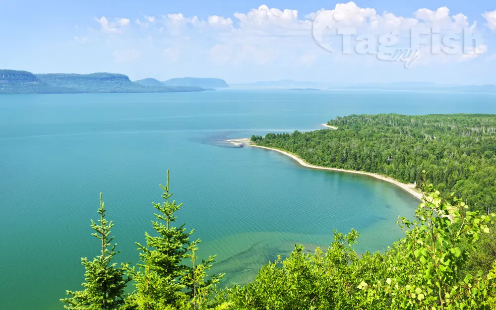
Lake Superior

General data
- Water type: Natural lake
- Progression: St. Marys River (Michigan–Ontario) -> Lake Huron -> St. Clair River -> Lake St. Clair (North America) -> Detroit river -> Lake Erie -> Niagara -> Lake Ontario -> St. Lawrence River -> Gulf of St. Lawrence -> Atlantic Ocean -> Planet Earth
- Climates: Continental
- Continents: North America
- Countries: Canada, United States of America
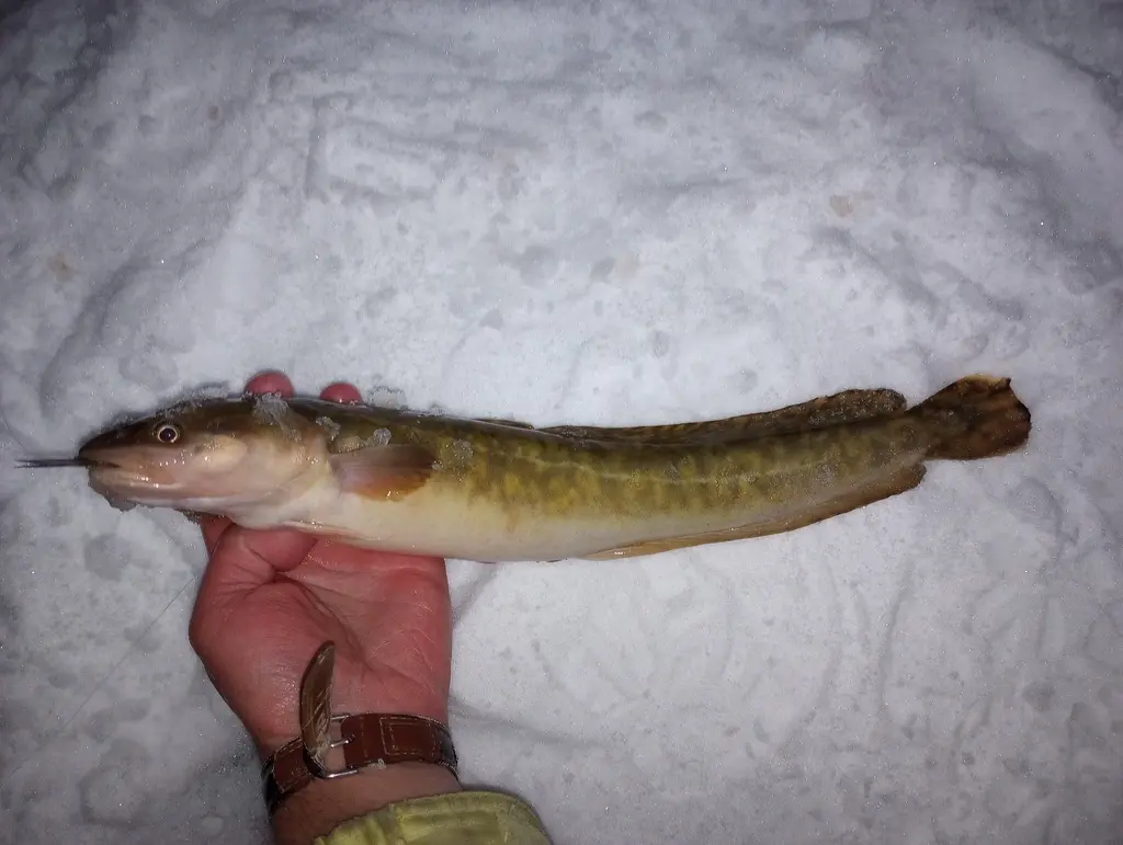
Description
Lake Superior is the largest and northernmost of the Great Lakes of North America, and among freshwater lakes, it is the worlds largest by surface area and the third-largest by volume. It holds 10% of the worlds surface fresh water. It is shared by Ontario, Canada to the north, and states in the United States in other directions: Minnesota to the west, and Wisconsin and the Upper Peninsula of Michigan to the south. Lake Superior is the most northerly and most westerly of the Great Lakes chain, and the highest in elevation. Lake Superior empties into Lake Huron via the St. Marys River and the Soo Locks (Sault Ste. Marie locks). Lake Superior is the largest freshwater lake in the world in area and the third largest in volume, behind Lake Baikal in Siberia and Lake Tanganyika in East Africa. The Caspian Sea, while larger than Lake Superior in both surface area and volume, is brackish. Though presently isolated, prehistorically the Caspian has been repeatedly connected to and then isolated from the Mediterranean via the Black Sea. Its average depth is 80.5 fathoms (483 ft; 147 m) with a maximum depth of 222.17 fathoms (1,333 ft; 406 m). Lake Superior contains 2,900 cubic miles (12,100 km³) of water. There is enough water in Lake Superior to cover the entire land mass of North and South America to a depth of 30 centimetres (12 in). The shoreline of the lake stretches 2,726 miles (4,387 km) (including islands). While the temperature of the surface of Lake Superior varies seasonally, the temperature below 110 fathoms (660 ft; 200 m) is an almost constant 39 °F (4 °C). This variation in temperature makes the lake seasonally stratified. Twice per year, however, the water column reaches a uniform temperature of 39 °F (4 °C) from top to bottom, and the lake waters thoroughly mix. This feature makes the lake dimictic. Because of its volume, Lake Superior has a retention time of 191 years. Annual storms on Lake Superior regularly feature wave heights of over 20 feet (6 m). Waves well over 30 feet (9 m) have been recorded. Lake Superior is fed by more than 200 rivers, including the Nipigon River, the St. Louis River, the Pigeon River, the Pic River, the White River, the Michipicoten River, the Bois Brule River and the Kaministiquia River. The lake\\\\\\\\\\\\\\\\\\\\\\\\\\\\\\\\\\\\\\\\\\\\\\\\\\\\\\\\\\\\\\\\\\\\\\\\\\\\\\\\\\\\\\\\\\\\\\\\\\\\\\\\\\\\\\\\\\\\\\\\\\\\\\\\\\\\\\\\\\\\\\\\\\\\\\\\\\\\\\\\\\\\\\\\\\\\\\\\\\\\\\\\\\\\\\\\\\\\\\\\\\\\\\\\\\\\\\\\\\\\\\\\\\\\\\\\\\\\\\\\\\\\\\\\\\\\\\\\\\\\\\\\\\\\\\\\\\\\\\\\\\\\\\\\\\\\\\\\\\\\\\\\\\\\\\\\\\\\\\\\\\\\\\\\\\\\\\\\\\\\\\\\\\\\\\\\\\\\\\\\\\\\\\\\\\\\\\\\\\\\\\\\\\\\\\\\\\\\\\\\\\\\\\\\\\\\\\\\\\\\\\\\\\\\\\\\\\\\\\\\\\\\\\\\\\\\\\\\\\\\\\\\\\\\\\\\\\\\\\\\\\\\\\\\\\\\\\\\\\\\\\\\\\\\\\\\\\\\\\\\\\\\\\\\\\\\\\\\\\\\\\\\\\\\\\\\\\\\\\\\\\\\\\\\\\\\\\\\\\\\\\\\\\\\\\\\\\\\\\\\\\\\\\\\\\\\\\\\\\\\\\\\\\\\\\\\\\\\\\\\\\\\\\\\\\\\\\\\\\\\\\\\\\\\\\\\\\\\\\\\\\\\\\\\\\\\\\\\\\\\\\\\\\\\\\\\\\\\\\\\\\\\\\\\\\\\\\\\\\\\\\\\\\\\\\\\\\\\\\\\\\\\\\\\\\\\\\\\\\\\\\\\\\\\\\\\\\\\\\\\\\\\\\\\\\\\\\\\\\\\\\\\\\\\\\\\\\\\\\\\\\\\\\\\\\\\\\\\\\\\\\\\\\\\\\\\\\\\\\\\\\\\\\\\\\\\\\\\\\\\\\\\\\\\\\\\\\\\\\\\\\\\\\\\\\\\\\\\\\\\\\\\\\\\\\\\\\\\\\\\\\\\\\\\\\\\\\\\\\\\\\\\\\\\\\\\\\\\\\\\\\\\\\\\\\\\\\\\\\\\\\\'s outlet at St. Marys River has a relatively steep gradient with rapids. The Soo Locks enable ships to bypass the rapids and to overcome the 25-foot (8 m) height difference between Lakes Superior and Huron.