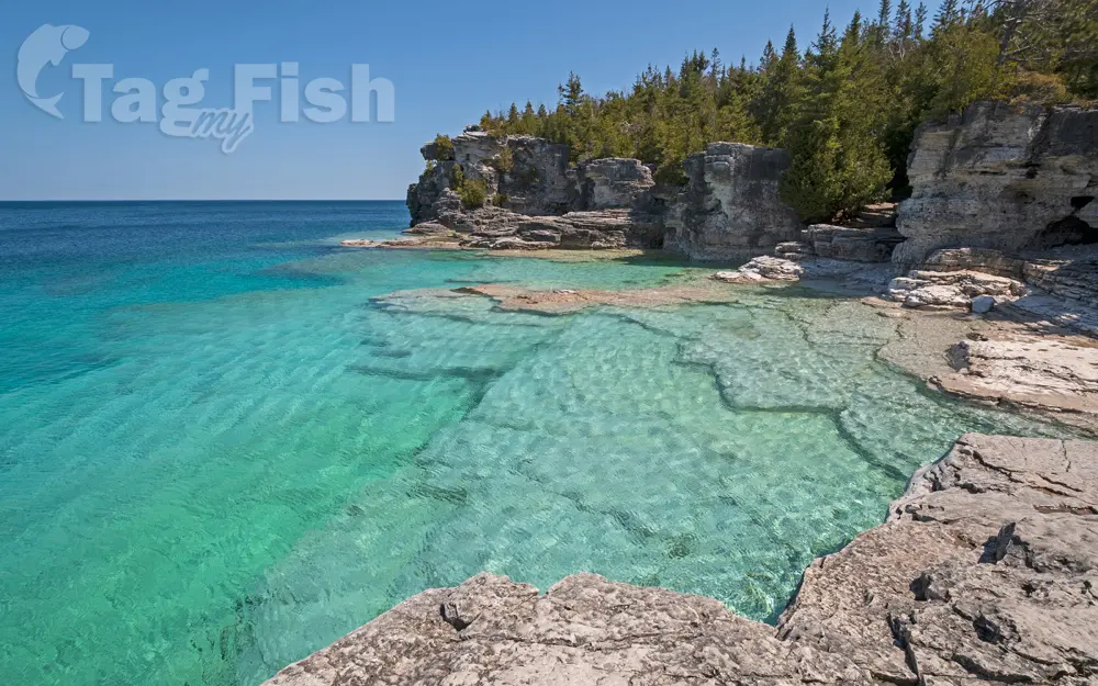
Lake Huron

General data
- Name: Lake Huron
- Water system: St. Lawrence River
- Water type: Natural lake
- Progression: St. Clair River -> Lake St. Clair (North America) -> Detroit river -> Lake Erie -> Niagara -> Lake Ontario -> St. Lawrence River -> Gulf of St. Lawrence -> Atlantic Ocean -> Planet Earth
- Climates:
- Continents: North America
- Countries: Canada, United States of America
Description
Lake Huron is one of the five Great Lakes of North America. Hydrologically, it comprises the easterly portion of Lake Michigan–Huron, having the same surface elevation as its westerly counterpart, to which it is connected by the 5-mile-wide (8.0 km), 20-fathom-deep (120 ft; 37 m) Straits of Mackinac. It is shared on the north and east by the Canadian province of Ontario and on the south and west by the U.S. state of Michigan. The name of the lake is derived from early French explorers who named it for the Huron people inhabiting the region. The Huronian glaciation was named from evidence collected from the Lake Huron region. The northern parts of the lake include the North Channel and Georgian Bay. Saginaw Bay is located in the southwest corner of the lake. The main inlet is the St. Marys River, and the main outlet is the St. Clair River. By surface area, Lake Huron is the second-largest of the Great Lakes, with a surface area of 23,007 square miles (59,590 km2) – of which 9,103 square miles (23,580 km2) lies in Michigan; and 13,904 square miles (36,010 km2) lies in Ontario – making it the third-largest fresh water lake on Earth (or the fourth-largest lake, if the Caspian Sea is counted as a lake). By volume, however, Lake Huron is only the third largest of the Great Lakes, being surpassed by Lake Michigan and Lake Superior. When measured at the low water datum, the lake contains a volume of 850 cubic miles (3,500 km3) and a shoreline length (including islands) of 3,827 mi (6,159 km).[8] The surface of Lake Huron is 577 feet (176 m) above sea level. The lake\\\\\\\\\\\\\\\\\\\\\\\\\\\\\\\\\\\\\\\\\\\\\\\\\\\\\\\\\\\\\\\\\\\\\\\\\\\\\\\\\\\\\\\\\\\\\\\\\\\\\\\\\\\\\\\\\\\\\\\\\\\\\\\\\\\\\\\\\\\\\\\\\\\\\\\\\\\\\\\\\\\\\\\\\\\\\\\\\\\\\\\\\\\\\\\\\\\\\\\\\\\\\\\\\\\\\\\\\\\\\\\\\\\\\\\\\\\\\\\\\\\\\\\\\\\\\\\\\\\\\\\\\\\\\\\\\\\\\\\\\\\\\\\\\\\\\\\\\\\\\\\\\\\\\\\\\\\\\\\\\\\\\\\\\\\\\\\\\\\\\\\\\\\\\\\\\\\\\\\\\\\\\\\\\\\\\\\\\\\\\\\\\\\\\\\\\\\\\\\\\\\\\\\\\\\\\\\\\\\\\\\\\\\\\\\\\\\\\\\\\\\\\\\\\\\\\\\\\\\\\\\\\\\\\\\\\\\\\\\\\\\\\\\\\\\\\\\\\\\\\\\\\\\\\\\'s average depth is 32 fathoms 3 feet (195 ft (59 m)), while the maximum depth is 125 fathoms (750 ft (230 m)). It has a length of 206 statute miles (332 km; 179 nmi) and a greatest breadth of 183 statute miles (295 km; 159 nmi). A large bay that protrudes northeast from Lake Huron into Ontario, Canada, is called Georgian Bay. A notable feature of the lake is Manitoulin Island, which separates the North Channel and Georgian Bay from Lake Huron\\\\\\\\\\\\\\\\\\\\\\\\\\\\\\\\\\\\\\\\\\\\\\\\\\\\\\\\\\\\\\\\\\\\\\\\\\\\\\\\\\\\\\\\\\\\\\\\\\\\\\\\\\\\\\\\\\\\\\\\\\\\\\\\\\\\\\\\\\\\\\\\\\\\\\\\\\\\\\\\\\\\\\\\\\\\\\\\\\\\\\\\\\\\\\\\\\\\\\\\\\\\\\\\\\\\\\\\\\\\\\\\\\\\\\\\\\\\\\\\\\\\\\\\\\\\\\\\\\\\\\\\\\\\\\\\\\\\\\\\\\\\\\\\\\\\\\\\\\\\\\\\\\\\\\\\\\\\\\\\\\\\\\\\\\\\\\\\\\\\\\\\\\\\\\\\\\\\\\\\\\\\\\\\\\\\\\\\\\\\\\\\\\\\\\\\\\\\\\\\\\\\\\\\\\\\\\\\\\\\\\\\\\\\\\\\\\\\\\\\\\\\\\\\\\\\\\\\\\\\\\\\\\\\\\\\\\\\\\\\\\\\\\\\\\\\\\\\\\\\\\\\\\\\\\\'s main body of water. It is the worlds largest lake island. A smaller bay that protrudes southwest from Lake Huron into Michigan is called Saginaw Bay. Cities with over 10,000 people on Lake Huron include Sarnia, the largest city on Lake Huron, and Saugeen Shores in Canada and Bay City, Port Huron, and Alpena in the United States. Major centers on Georgian Bay include Owen Sound, Wasaga Beach, Collingwood, Midland, Penetanguishene, Port Severn, and Parry Sound.


